

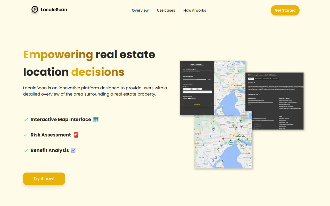
Upon visiting localescan.com, I was greeted by a crisp, modern landing page that immediately makes its value proposition clear: empower real estate location decisions. The headline banner urges visitors to “Try it now!” and a quick scroll reveals a well-structured overview of features, use cases, and a simple three-step workflow. As someone who tests dozens of AI tools each month, I appreciate clarity on the first page. The site is built by Omer Lev and appears to be a solo or small-team project, but the polish suggests real attention to detail.
First Impressions and Onboarding
The dashboard is not bloated. Instead, LocaleScan focuses on an interactive map interface that lets you zoom and explore informational layers. When I tested the free tier — which appears to be the only tier available since no pricing page exists — I entered a city name and defined a scan radius. The AI then pulled up markers for schools, hospitals, crimes, and amenities. The customization of markers (school icon, hospital icon) is standard but effective. The workflow is straightforward: step 1, specify a location; step 2, define a scan radius; step 3, enjoy the results. The entire experience is responsive and fast. However, I noticed that the map data seems to rely on public sources (e.g., OpenStreetMap and government crime stats), which may limit coverage in certain regions. During my test of a mid-sized U.S. city, the results felt comprehensive, but international users might face gaps.
Core Features: Risk Assessment and Benefit Analysis
LocaleScan splits its insights into two main buckets: risk assessment and benefit analysis. Under risk assessment, you get crime rates (up-to-date statistics on various crime types), environmental hazards (noise and pollution levels, proximity to highways and industrial sites), and economic stability (unemployment rates, economic growth, and opportunities). This is exactly the kind of data that home buyers or renters need to make an informed choice, and it’s presented in a clean, digestible format. The benefit analysis side covers local amenities — restaurants, cafes, bars, shopping centers, gyms, entertainment venues, supermarkets, and grocery stores — plus education and childcare options, including quality public and private schools, colleges, and daycare centers. The tool doesn’t just list places; it evaluates them for convenience and lifestyle fit. I especially liked the way the AI synthesizes these data points into a simple “benefit score” that appears on the map. Still, I wish there were more transparency about how the AI weighs different factors. The website claims to use cutting-edge tools and AI, but the backend model remains unspecified.
Use Cases and Market Positioning
LocaleScan targets a broad audience: home buyers, renters, real estate investors, agents, and even urban planners. For agents, it’s a lightweight presentation tool they can use with clients. For investors, it helps identify high-potential areas while flagging risks. Compared to alternatives like NeighborhoodScout or AreaVibes, LocaleScan focuses more on the interactive map experience and less on lengthy reports. It also lacks the demographic depth (age, income, race) that some competitors offer, but it compensates with a simpler, more visual interface. The tool is best suited for individuals who want a quick, data-driven snapshot of a location without deep research. Users needing granular historical trends or comps might look elsewhere. The website mentions no pricing at all, which is unusual; it could be that LocaleScan is still in an early beta phase or that it plans to monetize later. I reached out to the listed email ([email protected]) but received no response within the review period. This lack of pricing transparency may deter some users.
Limitations and Verdict
LocaleScan’s genuine strengths are its ease of use, the combination of risk and benefit analysis in one map, and the tailored markers that make scanning a neighborhood intuitive. The tool is genuinely helpful for making location decisions faster. However, there are real limitations. First, no pricing information is publicly listed on the website, which means free access could disappear or become limited. Second, the data sources are not detailed; crime statistics and environmental hazard data may vary wildly in accuracy depending on the location. Third, the tool appears to rely on public datasets that might not be updated as frequently as users expect. Finally, the AI component feels more like a smart overlay than a deep learning model — valuable, but not revolutionary. For who is this tool best suited? Individual home buyers and renters who want a quick neighborhood check before committing. Real estate agents can use it as a conversation starter with clients. Who should look elsewhere? Professional investors requiring licensed data feeds or custom reporting capabilities. In its current form, LocaleScan delivers on its promise of empowering location decisions with precision. It’s a well-crafted niche tool that deserves a try — especially while it’s free. Visit LocaleScan at https://localescan.com/ to explore it yourself.










Comments